Project
Foth Infrastructure & Environment, LLC
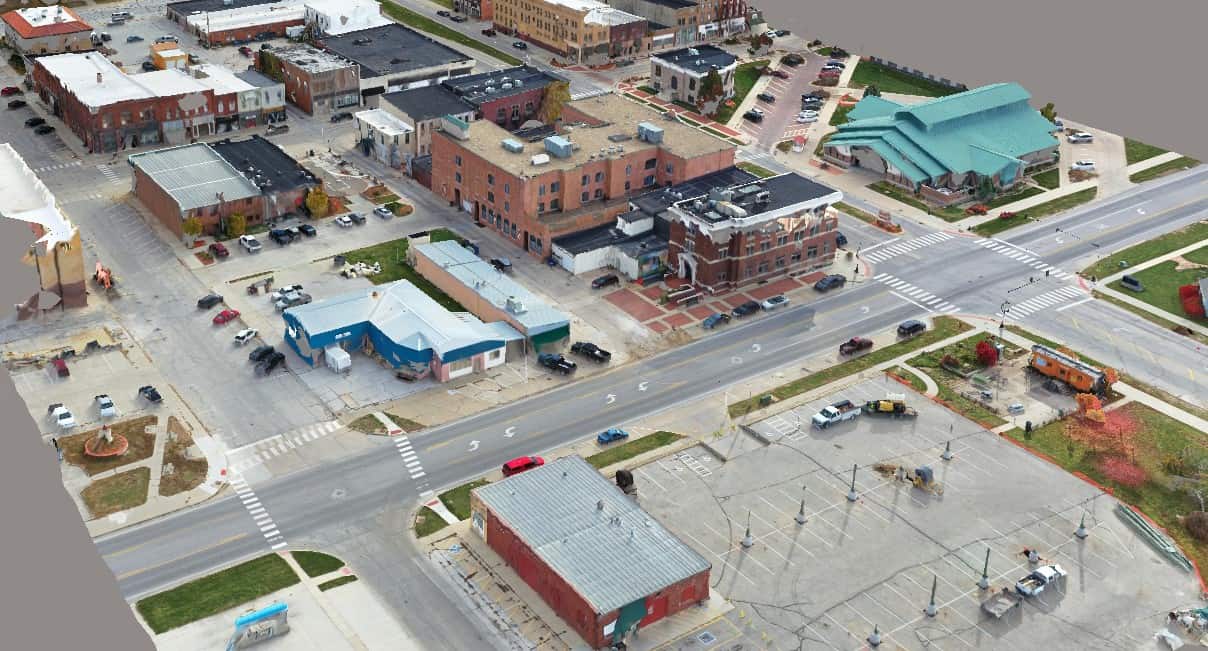
Foth와 함께 디지털 트윈을 사용하여 디지털 매핑 도시를 생성한 페리 시
Project
Foth Infrastructure & Environment, LLC
Foth와 함께 디지털 트윈을 사용하여 디지털 매핑 도시를 생성한 페리 시
도로 및 고속도로
Perry, Iowa, United States
사용된 Bentley 소프트웨어
ContextCapture, MicroStation, OpenRoads, ProjectWise
프로젝트 개요
The City of Perry hired Foth to evaluate street and sidewalk conditions using mobile LiDAR scanning to improve access for citizens. The project quickly morphed into a citywide digital twin project to support the city’s capital improvement plan (CIP), presenting technical challenges for digitalizing over 60 miles of streets and 10 miles of alleyways. Foth needed integrated technology to process voluminous geospatial data, aerial images, and point clouds, and provide digital accessibility to multiple stakeholders.Leveraging Bentley’s open modeling applications, Foth developed an optimal plan to deliver the digital twin, saving significant time and potential rework. The 500-gigabyte 3D city model contains approximately USD 598 million worth of asset data. The digital twin provides potential investors with a portfolio of data about historical structures, making them more inclined to invest in Perry and helping increase private investor engagement by 50% over the next five years. Having a digital twin enables Perry to gain support and enact its CIP 60% faster, increasing its ability to secure city funding by 75%.
