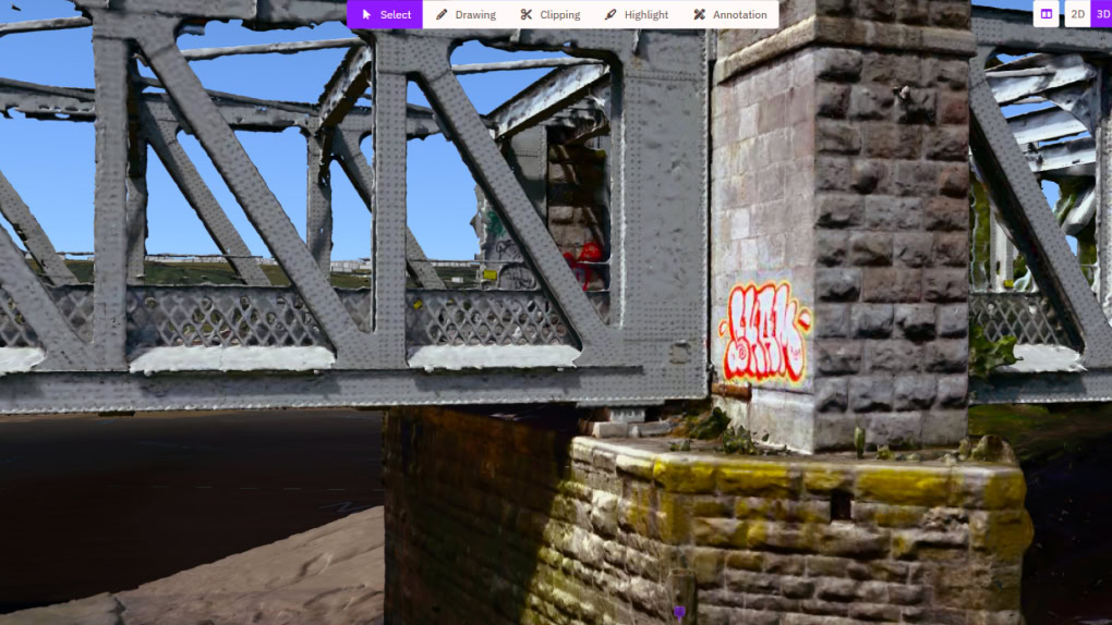
主页 / 项目 / 地理空间和实景建模 / 利用 3D 地理空间平台开展布里斯托尔港资产状况调查

项目

组织和公司名称

Mott MacDonald

利用 3D 地理空间平台开展布里斯托尔港资产状况调查

图片来源:Mott MacDonald
白色背景中有一个黑色圆圈,圆圈内有一个白色的“B”,圆圈下方有引用 YII 2025 的“决赛入围者 2025 ”字样,圆圈顶部有一个橙色条形。
带有橙色顶部边框的徽章在白色背景上显示着文字“决赛入围者 YII 2025”,显示了对 2025 年卓越项目的认可。

项目

组织和公司名称

Mott MacDonald

利用 3D 地理空间平台开展布里斯托尔港资产状况调查

图片来源:Mott MacDonald
奖项类别

地理空间和实景建模

地点

Bristol, Avon, United Kingdom

使用的 Bentley 软件

Cesium

项目概要

To help comply with scheduled inspections at Bristol Harbor, Bristol City Council engaged Mott MacDonald to collect detailed information for over 300 diverse above- and below-water assets. The project presented challenges surveying the assets and managing and accessing the collected data. Traditional on-site inspection techniques proved risky, costly, and time consuming. To replace these existing surveys, they wanted to use remote sensors to collect 3D spatial data. However, they needed technology that could bring the captured 3D data and images into an easily accessible, online environment, enabling condition assessment.

Mott MacDonald selected Cesium to bring collected data and 3D models of Bristol Harbor assets into a common, web-based platform, accessible to the client and stakeholders to view asset defects. Bentley’s application automated previous manual inspection works and enabled 50% more efficient data collection, 60% more effective asset defect identification, and spatial location. The digital solution provides ongoing digital monitoring and evidence of harbor condition, reducing infrastructure closures, limiting impact on vegetation, and ensuring the harbor’s sustainability.

Bentley 软件优惠 20%

优惠将于周五结束

使用优惠券码“THANKS24”

庆祝卓越的基础设施交付和性能

2024 年纵览基础设施大会基础设施数字化光辉大奖赛

提交项目参加基础设施领域获得广泛认可的大赛!项目提交截止日期延长至 4 月 29 日。