Cesium、iTwin Capture、Orbit
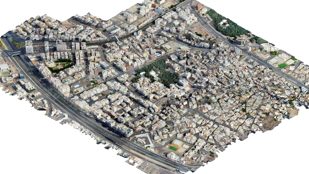
为了满足伊斯兰教第二大圣城麦地那的朝圣者游客量增长需求,支持文化保护和可持续发展,麦地那地区发展局启动了一项全面范围的测绘和实景建模勘测工作,以构建 Manarah 城市数据平台。面对数据处理、集成和监管挑战,麦地那地区发展局评估了多种技术解决方案,但很快意识到这些方案难以满足项目规模和无缝访问数据所需的处理能力、数据互用性和图像质量。
麦地那地区发展局最终选择了 Bentley iTwin Capture 来采集并生成 55 平方公里城市区域的实景模型,将 6.6 平方公里区域的数据采集时间缩短了 43%。采用 Cesium 促进了模型与 Manarah 城市数据平台的集成,使决策者能够通过 3D 可视化以获得实时态势感知。数字孪生解决方案助力保护 57 处历史遗址和 1.45 平方公里的城市农业区。Bentley 技术助力支持麦地那数字城市数据平台的发展,实现更智能的规划,保护了文化遗产,并为该市打造具有灾后快速恢复和适应变化能力以及数据驱动型未来做好准备。
提交项目参加基础设施领域获得广泛认可的大赛!项目提交截止日期延长至 4 月 29 日。
正在跳转至目标页面,请稍候……
