Project
Project
Surveying and monitoring
브라질 리우데자네이루
사용된 Bentley 소프트웨어
ContextCapture, iTwin, LumenRT, MicroStation, OpenBuildings, OpenCities, ProjectWise
프로젝트 개요
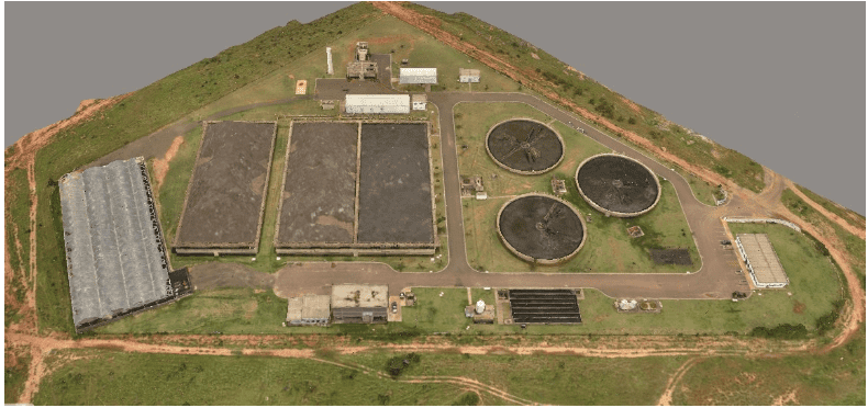
The Infra Inteligente program aims to identify and verify all physical assets of Aegea’s sanitation operation by creating a digital 3D map of their structures located across 13 Brazilian states. As part of this digitalization program, Aegea implemented its largest asset inventory project in Rio de Janeiro, requiring capturing and integrating more than 29,000 physical assets, 1,317 industrial plants, and 211,000 surveys. To enable 70 specialists from multiple engineering disciplines to complete the project, Aegea needed integrated BIM and reality modeling technology.Leveraging ContextCapture and Bentley’s open modeling applications, Aegea processed a total of 156,000 drone-captured photos to generate a 3D reality mesh and digital twin. Creating a virtual reality environment provides real-time asset and plant insight to monitor equipment health and operation, enabling digital lifecycle management of sanitation assets, optimizing performance, service availability, and reliability. The 3D digital solution ensures risk mitigation and operational efficiencies and facilitates the modernization of Aegea’s sanitation network.
