Project
Nom de l'organisation et de l'entreprise
Macquarie Geotechnical
Modélisation de la réalité souterraine pour une meilleure connaissance du sous-sol
Crédit image : Macquarie Geotechnical
Project
Nom de l'organisation et de l'entreprise
Macquarie Geotechnical
Modélisation de la réalité souterraine pour une meilleure connaissance du sous-sol
Crédit image : Macquarie Geotechnical
Catégorie de prix
Modélisation et analyse du sous-sol
Lieu
Nouvelle-Galles du Sud, Australie
Logiciel Bentley utilisé
iTwin Capture, Leapfrog
Résumé du projet
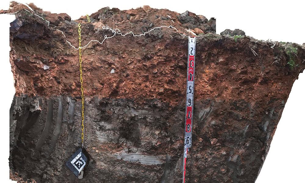
Australian ground investigation firm Macquarie Geotechnical selected two sample projects to demonstrate the importance of data capture and intuitive communication of subsurface information. One was a regional highway pavement investigation project with considerable variation in layer thickness, and the other was a greenfield rail project that exhibited shrink-swell behavior. Macquarie experimented with various applications to overcome the shortcomings of traditional geotechnical investigation approaches. However, these lacked the technical and interoperable features for seamless digital workflows.Macquarie selected iTwin Capture and Leapfrog to augment traditional geotechnical data and modeling with subsurface photogrammetry. Using Bentley’s integrated applications allowed for more accurate modeling and provided a visual, contextual understanding of the subsurface conditions for stakeholders in formats compatible with their civil design software. The detail captured in the models allowed fieldwork to progress without the need for key decision makers to be on site, estimated to save AUD 90,000 in time and travel costs. The reality modeling solution also saved approximately 600,000 cubic meters of quarried materials, achieving significant financial and carbon benefits.
