Winner
Al Madinah Region Development Authority (MDA)
Manarah urban data platform
Winner
Al Madinah Region Development Authority (MDA)
Manarah urban data platform
Geospatial and reality modeling
Al Madinah, Saudi Arabia
Bentley software used
Cesium, iTwin Capture, Orbit
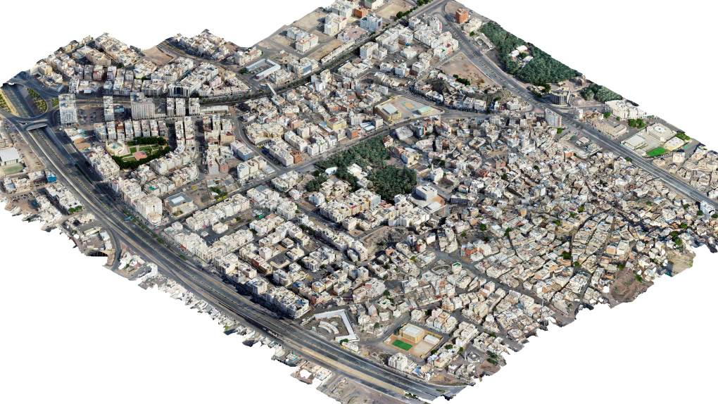
Project summary
To support pilgrim travel growth, cultural preservation, and sustainability in Islam’s second-holiest city of Al Madinah, MDA launched a comprehensive mapping and reality modeling survey to establish the Manarah Urban Data Platform (MUDP). Faced with data processing, integration, and regulatory challenges, MDA evaluated multiple technology solutions, but quickly realized that they lacked the processing capabilities, interoperability, and image quality necessary to accommodate the project scale and ensure seamless data accessibility.
MDA ultimately selected Bentley iTwin Capture to capture and generate reality models for 55 square kilometers of the city, reducing data acquisition time for a 6.6-square-kilometer area by 43%. Using Cesium facilitated model integration with their MUDP, providing decision makers access to 3D visualizations to gain real-time situational awareness. The digital twin solution helped preserve 57 heritage sites and 1.45 square kilometers of urban agriculture. Supporting Madinah’s digital urban data platform development, Bentley technology enables smarter planning, safeguards cultural heritage, and prepares the city for a resilient data-driven future.
