Project
PT Hutama Karya
Trans Papua Road – Mamberamo-Elelim section
Project
PT Hutama Karya
Trans Papua Road – Mamberamo-Elelim section
Founder's Honor
Mamberamo-Elelim, Jayapura-Papua Highlands, Indonesia
Bentley software used
GeoStudio, iTwin Capture, Leapfrog, PLAXIS
Project summary
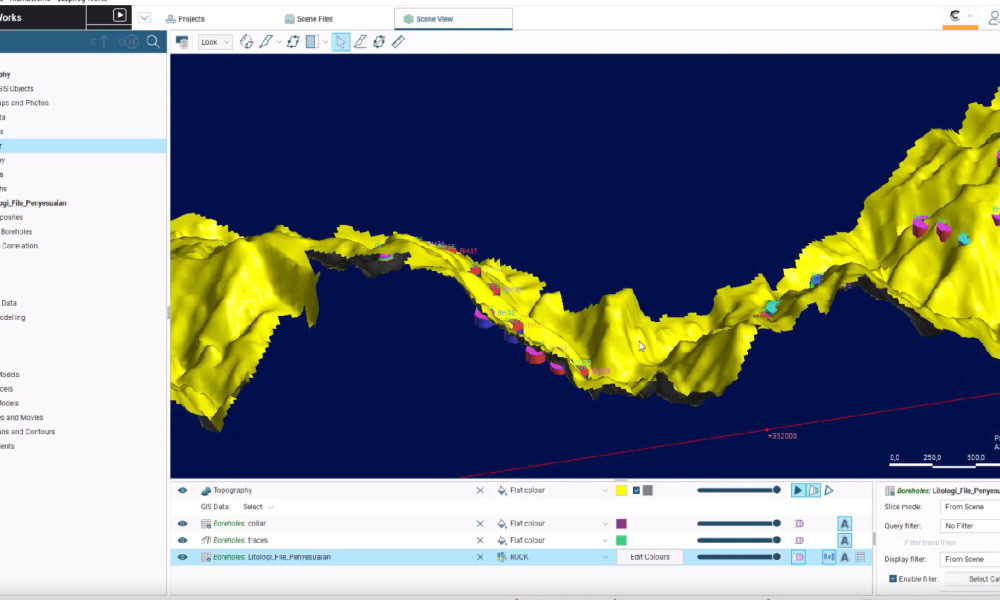
Spanning 50.14 kilometers across Papua, the Mamberamo-Elelim section of the Trans Papua roadway project serves as a critical connection corridor, reducing travel times from five or six hours to one hour and 20 minutes, bringing life-changing accessibility to one of Indonesia’s most isolated mountainous regions. Hutama Karya is leading the project and faced steep terrain, high rainfall, and erosion-prone slopes, limiting accessibility and subsurface data collection quality. To overcome geographical isolation, geotechnical uncertainty, and logistical complexities, Hutama Karya needed integrated geoengineering technology.
Hutama Karya leveraged Bentley iTwin Capture to generate a precise 3D reality terrain mesh, using Leapfrog, GeoStudio, and PLAXIS to perform geotechnical and subsurface modeling and analysis. This process provided visual and topographical insight to optimize design and save up to USD 1 million in costs. Bentley’s integrated applications facilitated comprehensive slope stability analysis and risk mitigation strategies, saving approximately USD 2.5 million in potential rework and reducing carbon emissions by 49,672 kilograms. The digital solution ensured accurate planning, efficient design, and sustainable delivery.
